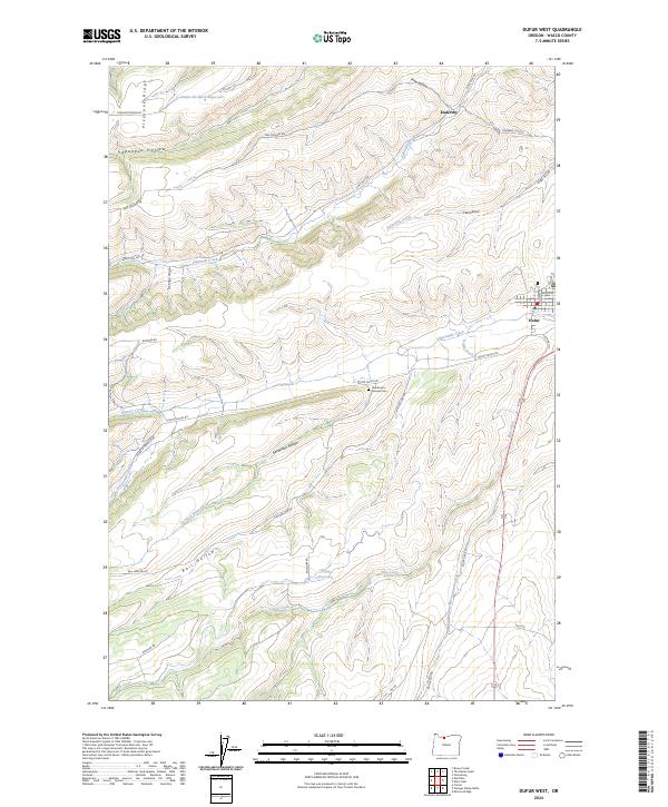
2024 Map of Dufur West
USGS Topo · Published 2024About this map
Fifteenmile Creek and Eightmile Creek carve through the agricultural landscape of Wasco County, defining the drainage patterns that support the region's orchard economy. The settlement of Dufur sits on the eastern edge of the sheet, where local streets like Williams St and Court St transition into the surrounding valley. This modern survey illustrates the critical infrastructure of high-desert farming, highlighting features like the Dufur Ditch and the Orchard Ridge Ditch, which carry water from the Dufur-Orchards Reservoir and Chase Reservoir to the fields.
Find a feature on this map
42 named features on this map. Tap any name to fly to it.
Don’t see what you’re looking for? This feature index may not catch every label — zoom into the map to look around manually.
Map Details
Editions of this 2024 Dufur West Map
This is the sole edition of this map. No revisions or reprints were ever made.
Other maps of this area

1930 · Dufur
USGS Topo · 1:125,000

1934 · Dufur
USGS Topo · 1:125,000

1934 · The Dalles
USGS Topo · 1:125,000

1953 · The Dalles
USGS Topo · 1:250,000

1956 · The Dalles
USGS Topo · 1:250,000

1957 · The Dalles
USGS Topo · 1:250,000

1957 · The Dalles
USGS Topo · 1:62,500

1957 · White Salmon
USGS Topo · 1:62,500

1962 · Sherars Bridge
USGS Topo · 1:24,000

1962 · Wolf Run
USGS Topo · 1:24,000