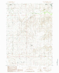
1984 Map of Dugout Creek North
USGS Topo · Published 1984About this map
Rochelle Hills and the Red Hills dominate this high-plains landscape along the border of Campbell and Converse Counties. The area is defined by an intricate network of drainage systems, including the headwaters of Antelope Creek and Horse Creek in the north, and Woody Creek and Dugout Creek to the south. This terrain is marked by deep erosional features like Logan Draw and Thomas Draw, which illustrate the complex topography of the Powder River Basin. Human presence is sparse, centered primarily on water management for ranching or local industry, as evidenced by Black Hill Reservoir and the Porcupine Reservoir tucked into the northeastern corner. The map provides a detailed look at the section lines and rural tracks that structured this Wyoming landscape during the late twentieth century.
Find a feature on this map
15 named features on this map. Tap any name to fly to it.
Don’t see what you’re looking for? This feature index may not catch every label — zoom into the map to look around manually.
Map Details
Editions of this 1984 Dugout Creek North Map
This is the sole edition of this map. No revisions or reprints were ever made.
Other maps of this area

1955 · Newcastle
USGS Topo · 1:250,000

1958 · Newcastle
USGS Topo · 1:250,000

1959 · Betty Reservoir
USGS Topo · 1:62,500

1971 · Coal Bank Draw
USGS Topo · 1:24,000

1971 · Teckla
USGS Topo · 1:24,000

1971 · Piney Canyon SW
USGS Topo · 1:24,000

1971 · Teckla SW
USGS Topo · 1:24,000

1971 · Tin Can Lake
USGS Topo · 1:24,000

1974 · Reno Junction
USGS Topo · 1:100,000

1979 · Bill
USGS Topo · 1:100,000