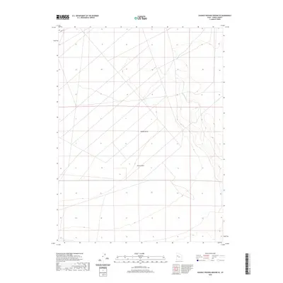
2020 Map of Dugway Proving Ground SE
USGS Topo · Published 2020About this map
Dugway Valley defines this arid landscape in Tooele County, where the topography reveals a stark, high-desert environment characterized by ancient drainage systems and vast open basins. The most prominent hydrological feature is the Old River Bed, a significant geological trace of a prehistoric waterway that once carved through this region. This modern topographic study, based on U.S. Census Bureau road data and GNIS nomenclature, illustrates the intersection of military land use and natural desert features. The sparsely populated area is navigated primarily via utility routes like Stark Rd, while seasonal drainage is captured by features such as Pismire Wash. The landform patterns here show a distinctive transition from the broad flats of the valley floor to the rising contours of the surrounding desert ranges.
Find a feature on this map
4 named features on this map. Tap any name to fly to it.
Don’t see what you’re looking for? This feature index may not catch every label — zoom into the map to look around manually.
Map Details
Editions of this 2020 Dugway Proving Ground SE Map
This is the sole edition of this map. No revisions or reprints were ever made.
Other maps of this area

1885 · Sevier Desert
USGS Topo · 1:250,000

1885 · Tooele Valley
USGS Topo · 1:250,000

1908 · Fish Springs
USGS Topo · 1:250,000

1910 · Fish Springs
USGS Topo · 1:250,000

1953 · Dugway Range NE
USGS Topo · 1:24,000

1953 · Dugway Range
USGS Topo · 1:62,500

1953 · Dugway Range NW
USGS Topo · 1:24,000

1953 · Tooele
USGS Topo · 1:250,000

1953 · Delta
USGS Topo · 1:250,000

1954 · Dugway Proving Ground SE
USGS Topo · 1:24,000