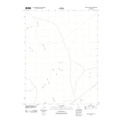
2010 Map of Dugway Range NE
USGS Topo · Published 2010About this map
The Dugway Range and its prominent Dugway Ridge dominate this desert landscape, characterized by a series of deeply etched drainage systems. The terrain transitions from the high point at Pyramid Peak down through several named canyons, including the interestingly titled Fandangle Canyon, Engelmann Canyon, and Shadscale Canyon. This 2010 survey illustrates the isolation of the Great Salt Lake Desert region, where water management is critical, as evidenced by the lonely Monument Reservoir in the southeast corner. The primary artery through this arid expanse is the Simpson Springs-Callao Rd, which skirts the southern edge of the range. The map reveals the intricate network of washes, such as Pismire Wash and the Shadscale Canyon Trailer Wash, which define the hydrological patterns of Green Grass Valley during rare desert precipitation events.
Find a feature on this map
13 named features on this map. Tap any name to fly to it.
Don’t see what you’re looking for? This feature index may not catch every label — zoom into the map to look around manually.
Map Details
Editions of this 2010 Dugway Range NE Map
This is the sole edition of this map. No revisions or reprints were ever made.
Other maps of this area

1885 · Sevier Desert
USGS Topo · 1:250,000

1885 · Tooele Valley
USGS Topo · 1:250,000

1908 · Fish Springs
USGS Topo · 1:250,000

1910 · Fish Springs
USGS Topo · 1:250,000

1953 · Dugway Range NE
USGS Topo · 1:24,000

1953 · Dugway Pass
USGS Topo · 1:24,000

1953 · Dugway Range
USGS Topo · 1:62,500

1953 · Dugway Range NW
USGS Topo · 1:24,000

1953 · Tooele
USGS Topo · 1:250,000

1953 · Delta
USGS Topo · 1:250,000