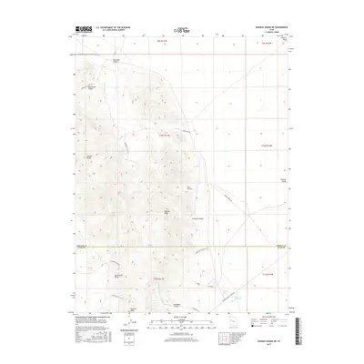
2017 Map of Dugway Range NE
USGS Topo · Published 2017About this map
Dugway Range dominates this corner of the Great Basin, where the border between Tooele and Juab counties cuts through high desert terrain. The landscape is defined by a series of steep drainages and isolated peaks, notably Pyramid Peak and the prominent Dugway Ridge. Human presence is marked by a network of specialized roads and desert crossings such as the Simpson Springs-Callao Rd and the Dugway Cutoff Rd, which navigate the transitions between mountain passes and the level Dugway Valley. Water management in this arid environment is evidenced by Monument Reservoir and several seasonal drainages including Trailer Wash and Pismire Wash. The inclusion of the Buckhorn Canyon & Rainbow Mine Rd in the north suggests the region's historical connection to mineral exploration, while canyons like Fera Canyon and Shadscale Canyon provide distinct landmarks for geologists and backcountry researchers.
Find a feature on this map
33 named features on this map. Tap any name to fly to it.
Don’t see what you’re looking for? This feature index may not catch every label — zoom into the map to look around manually.
Map Details
Editions of this 2017 Dugway Range NE Map
This is the sole edition of this map. No revisions or reprints were ever made.
Other maps of this area

1885 · Sevier Desert
USGS Topo · 1:250,000

1885 · Tooele Valley
USGS Topo · 1:250,000

1908 · Fish Springs
USGS Topo · 1:250,000

1910 · Fish Springs
USGS Topo · 1:250,000

1953 · Dugway Range NE
USGS Topo · 1:24,000

1953 · Dugway Pass
USGS Topo · 1:24,000

1953 · Dugway Range
USGS Topo · 1:62,500

1953 · Dugway Range NW
USGS Topo · 1:24,000

1953 · Tooele
USGS Topo · 1:250,000

1953 · Delta
USGS Topo · 1:250,000