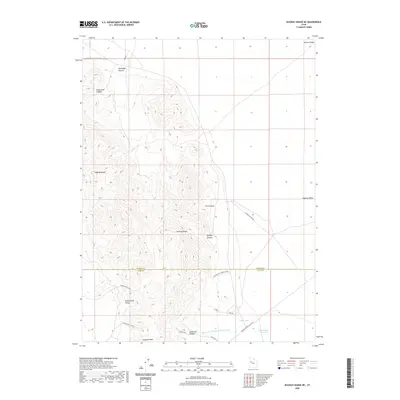
2020 Map of Dugway Range NE
USGS Topo · Published 2020About this map
The Dugway Range dominates this portion of the Great Basin, where Tooele and Juab counties meet in a landscape of high ridges and desert washes. The interior of the range is carved by numerous canyons, including Fera Canyon and Engelmann Canyon, while the southern reaches drop toward Green Grass Valley and the prominent Pyramid Peak. This 2020 survey illustrates the remote network of gravel paths and unimproved roads that serve the area, such as the Buckhorn Canyon & Rainbow Mine Rd and Simpson Springs-Callao Rd. These routes imply a history of mineral exploration and ranching, evidenced by features like the Monument Reservoir and the Dugway Cutoff Rd slicing through the eastern Dugway Valley. To the south, Shadscale Canyon and its associated washes drain the high ground, providing a detailed look at the drainage patterns of this arid environment.
Find a feature on this map
25 named features on this map. Tap any name to fly to it.
Don’t see what you’re looking for? This feature index may not catch every label — zoom into the map to look around manually.
Map Details
Editions of this 2020 Dugway Range NE Map
This is the sole edition of this map. No revisions or reprints were ever made.
Other maps of this area

1885 · Sevier Desert
USGS Topo · 1:250,000

1885 · Tooele Valley
USGS Topo · 1:250,000

1908 · Fish Springs
USGS Topo · 1:250,000

1910 · Fish Springs
USGS Topo · 1:250,000

1953 · Dugway Range NE
USGS Topo · 1:24,000

1953 · Dugway Pass
USGS Topo · 1:24,000

1953 · Dugway Range
USGS Topo · 1:62,500

1953 · Dugway Range NW
USGS Topo · 1:24,000

1953 · Tooele
USGS Topo · 1:250,000

1953 · Delta
USGS Topo · 1:250,000