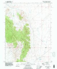
1993 Map of Dugway Range NE
USGS Topo · Published 1996About this map
Dugway Ridge dominates this arid landscape at the boundary of Tooele and Juab counties, where deep drainages like Fandangle Canyon and Engelmann Canyon cut through the high desert. The 1990s terrain is characterized by a network of 4WD trails connecting critical water sources in a remote environment, including Fandangle Well and the Dugway Topaz Well to the south. This mapping of the eastern Dugway Range highlights the importance of localized geography for navigation and survival in the basin and range province.
Find a feature on this map
16 named features on this map. Tap any name to fly to it.
Don’t see what you’re looking for? This feature index may not catch every label — zoom into the map to look around manually.
Map Details
Editions of this 1993 Dugway Range NE Map
This is the sole edition of this map. No revisions or reprints were ever made.
Other maps of this area

1885 · Sevier Desert
USGS Topo · 1:250,000

1885 · Tooele Valley
USGS Topo · 1:250,000

1908 · Fish Springs
USGS Topo · 1:250,000

1910 · Fish Springs
USGS Topo · 1:250,000

1953 · Dugway Range NE
USGS Topo · 1:24,000

1953 · Dugway Pass
USGS Topo · 1:24,000

1953 · Dugway Range
USGS Topo · 1:62,500

1953 · Dugway Range NW
USGS Topo · 1:24,000

1953 · Tooele
USGS Topo · 1:250,000

1953 · Delta
USGS Topo · 1:250,000