
1956 Map of Duluth
USGS Topo · Published 1957About this map
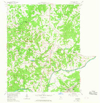
The Chattahoochee River forms a natural boundary between the rural uplands of Fulton and Gwinnett counties, anchored at the southern edge by the town of Duluth. This mid-century survey reveals an agrarian landscape transitioning into a suburban corridor, marked by a dense network of family-named roads and rural institutions. Significant local landmarks include Hull High Sch and Dodd Sch, alongside numerous country churches like Bethlehem Ch, Clear Springs Ch, and Macedonia Ch which served the surrounding farming communities. The Southern Railway cuts through the southeastern corner, while historic crossing points such as Abbotts Bridge Road and Medlock Bridge Road hint at the original river-crossing infrastructure. Small settlements such as Shake Rag, Ocee, and Warsaw are depicted before the rapid expansion of the metropolitan Atlanta area altered these communities.
Find a feature on this map
64 named features on this map. Tap any name to fly to it.
Don’t see what you’re looking for? This feature index may not catch every label — zoom into the map to look around manually.
Map Details
Editions of this 1956 Duluth Map
4 editions found
Other maps of this area

1888 · Atlanta
USGS Topo · 1:125,000

1890 · Suwanee
USGS Topo · 1:125,000

1890 · Atlanta
USGS Topo · 1:125,000

1892 · Atlanta
USGS Topo · 1:125,000

1894 · Suwanee
USGS Topo · 1:125,000

1895 · Atlanta
USGS Topo · 1:125,000

1953 · Atlanta
USGS Topo · 1:250,000

1954 · Chamblee
USGS Topo · 1:24,000

1955 · Rome
USGS Topo · 1:250,000
1956 · Norcross
USGS Topo · 1:24,000