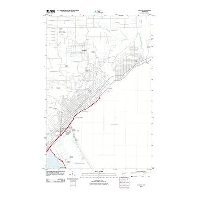
2010 Map of Duluth
USGS Topo · Published 2010About this map
Lake Superior dominates the eastern edge of this coastal landscape, where the urban center of Duluth meets the working waterfront of the Duluth Harbor Basin. The geography is defined by the steep rise from the shore toward residential neighborhoods like Woodland and Hunters Park, bisected by numerous watercourses including Tischer Creek and Chester Creek. The industrial and maritime legacy of the city is evident at Rices Point, home to the Seaway Port Authority of Duluth, and across the complex network of docks and slips near the Aerial Lift Bridge.
Find a feature on this map
67 named features on this map. Tap any name to fly to it.
Don’t see what you’re looking for? This feature index may not catch every label — zoom into the map to look around manually.
Map Details
Editions of this 2010 Duluth Map
This is the sole edition of this map. No revisions or reprints were ever made.
Other maps of this area

1895 · Duluth
USGS Topo · 1:62,500

1915 · Superior
USGS Topo · 1:48,000

1917 · Superior
USGS Topo · 1:62,500

1949 · Poplar
USGS Topo · 1:48,000

1953 · Lakewood
USGS Topo · 1:24,000

1953 · French River
USGS Topo · 1:24,000

1953 · Arnold
USGS Topo · 1:24,000

1953 · Duluth
USGS Topo · 1:24,000

1953 · Duluth Heights
USGS Topo · 1:24,000

1953 · Fredenberg
USGS Topo · 1:24,000