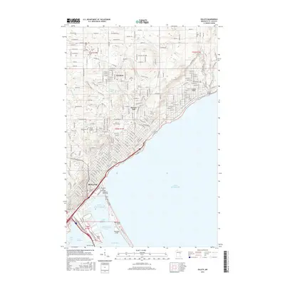
2016 Map of Duluth
USGS Topo · Published 2016About this map
Duluth sits at the southwestern tip of Lake Superior, where the city's complex shoreline meets the industrial and maritime infrastructure of the Duluth Harbor Basin. The urban landscape is defined by its dramatic elevation changes, with residential neighborhoods like Woodland and Hunters Park perched on the heights above the water. A dense network of cemeteries, including Tifereth Israel Cem, Polish Cem, and Park Hill Cem, provides a detailed record of the community's diverse heritage.
Find a feature on this map
150 named features on this map. Tap any name to fly to it.
Don’t see what you’re looking for? This feature index may not catch every label — zoom into the map to look around manually.
Map Details
Editions of this 2016 Duluth Map
This is the sole edition of this map. No revisions or reprints were ever made.
Other maps of this area

1895 · Duluth
USGS Topo · 1:62,500

1915 · Superior
USGS Topo · 1:48,000

1917 · Superior
USGS Topo · 1:62,500

1949 · Poplar
USGS Topo · 1:48,000

1953 · Lakewood
USGS Topo · 1:24,000

1953 · French River
USGS Topo · 1:24,000

1953 · Arnold
USGS Topo · 1:24,000

1953 · Duluth
USGS Topo · 1:24,000

1953 · Duluth Heights
USGS Topo · 1:24,000

1953 · Fredenberg
USGS Topo · 1:24,000