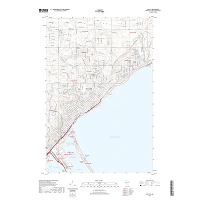
2019 Map of Duluth
USGS Topo · Published 2019About this map
The industrial and maritime core of Duluth dominates this landscape, where the city meets the expansive waters of Lake Superior. The map illustrates the complex infrastructure of the port, including the Duluth Harbor Basin Northern Section and the landmark Aerial Lift Bridge. Along the shoreline, specialized features like the Minnesota Slip Drawbridge and Lake Place Tunnel facilitate movement between the urban center and the waterfront. The residential and institutional character of the city is evident in the inclusion of The College of Saint Scholastica and the Univ of Minnesota Duluth.
Find a feature on this map
134 named features on this map. Tap any name to fly to it.
Don’t see what you’re looking for? This feature index may not catch every label — zoom into the map to look around manually.
Map Details
Editions of this 2019 Duluth Map
This is the sole edition of this map. No revisions or reprints were ever made.
Other maps of this area

1895 · Duluth
USGS Topo · 1:62,500

1915 · Superior
USGS Topo · 1:48,000

1917 · Superior
USGS Topo · 1:62,500

1949 · Poplar
USGS Topo · 1:48,000

1953 · Lakewood
USGS Topo · 1:24,000

1953 · French River
USGS Topo · 1:24,000

1953 · Arnold
USGS Topo · 1:24,000

1953 · Duluth
USGS Topo · 1:24,000

1953 · Duluth Heights
USGS Topo · 1:24,000

1953 · Fredenberg
USGS Topo · 1:24,000