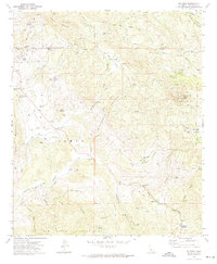
1972 Map of Dulzura
USGS Topo · Published 1974About this map
Jamul and the neighboring hills of North Jamul anchor this inland Southern California landscape, where the chaparral-covered slopes of the Jamul Mountains and San Ysidro Mountains meet a network of ranching and early residential outposts. The 1970s terrain is marked by a complex system of fire roads and truck trails, including the Minnewawa Truck Trail and the California Riding and Hiking Trail, which connect dispersed ranch sites like Honey Springs Ranch, Mountain Shadows Ranch, and Mocogo Ranch.
Find a feature on this map
56 named features on this map. Tap any name to fly to it.
Don’t see what you’re looking for? This feature index may not catch every label — zoom into the map to look around manually.
Map Details
Editions of this 1972 Dulzura Map
4 editions found
Other maps of this area

1893 · El Cajon
USGS Topo · 1:62,500

1901 · Elcajon
USGS Topo · 1:62,500

1903 · Cuyamaca
USGS Topo · 1:125,000

1903 · Elcajon
USGS Topo · 1:62,500

1904 · Southern California Sheet No. 2
USGS Topo · 1:250,000

1939 · El Cajon
USGS Topo · 1:62,500

1942 · Potrero
USGS Topo · 1:48,000

1942 · El Cajon
USGS Topo · 1:62,500

1942 · Cuyamaca Peak
USGS Topo · 1:62,500

1943 · Jamul
USGS Topo · 1:62,500