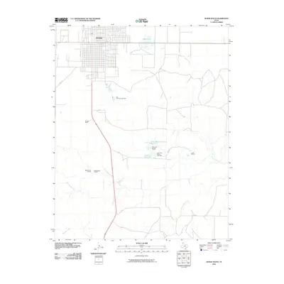
2010 Map of Dumas South
USGS Topo · Published 2010About this map
The southern outskirts of Dumas anchor this West Texas survey, revealing a landscape where municipal growth meets established cattle operations. The town's grid extends southward toward Burnett Ranch, while the surrounding plains are defined by intermittent water sources and ranching infrastructure. Private aviation is represented by the Beauchamp Airstrip, located near the Beauchamp Ranch in the southwestern portion of the quadrangle.
Find a feature on this map
22 named features on this map. Tap any name to fly to it.
Don’t see what you’re looking for? This feature index may not catch every label — zoom into the map to look around manually.
Map Details
Editions of this 2010 Dumas South Map
This is the sole edition of this map. No revisions or reprints were ever made.
Other maps of this area

1936 · Fourways
USGS Topo · 1:62,500

1953 · Masterson
USGS Topo · 1:24,000

1953 · Spencer Draw
USGS Topo · 1:24,000

1954 · Tucumcari
USGS Topo · 1:250,000

1954 · Amarillo
USGS Topo · 1:250,000

1958 · Amarillo
USGS Topo · 1:250,000

1958 · Tucumcari
USGS Topo · 1:250,000

1963 · Stallwitz Lake
USGS Topo · 1:24,000

1965 · Dumas South
USGS Topo · 1:24,000
1965 · Stallwitz Lake NE
USGS Topo · 1:24,000