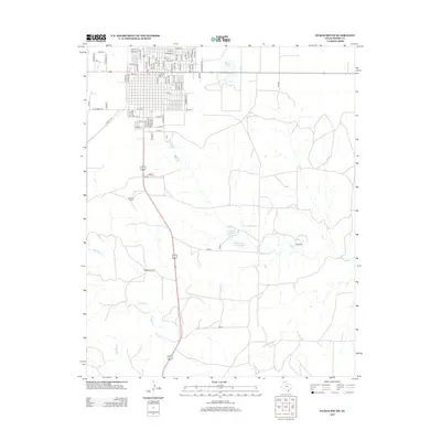
2013 Map of Dumas South
USGS Topo · Published 2013About this map
Moore County's expansive High Plains terrain is documented in this 2013 survey, showcasing the rural landscapes south of the Dumas city center. The geography is defined by a series of intermittent watercourses and ranching operations, including the Burnett Ranch and Beauchamp Ranch. These local landmarks are situated along the transit corridor of 87 287, which serves as the primary north-south artery through the region.
Find a feature on this map
86 named features on this map. Tap any name to fly to it.
Don’t see what you’re looking for? This feature index may not catch every label — zoom into the map to look around manually.
Map Details
Editions of this 2013 Dumas South Map
This is the sole edition of this map. No revisions or reprints were ever made.
Other maps of this area

1936 · Fourways
USGS Topo · 1:62,500

1953 · Masterson
USGS Topo · 1:24,000

1953 · Spencer Draw
USGS Topo · 1:24,000

1954 · Tucumcari
USGS Topo · 1:250,000

1954 · Amarillo
USGS Topo · 1:250,000

1958 · Amarillo
USGS Topo · 1:250,000

1958 · Tucumcari
USGS Topo · 1:250,000

1963 · Stallwitz Lake
USGS Topo · 1:24,000

1965 · Dumas South
USGS Topo · 1:24,000
1965 · Stallwitz Lake NE
USGS Topo · 1:24,000