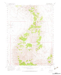
1961 Map of Dun Glen
USGS Topo · Published 1983About this map
Dun Glen and its surrounding canyons reflect a landscape defined by Nevada's mining history and scattered ranching outposts. This 1961 survey details a network of hard-rock operations along the eastern slopes, including the Montezuma Mine, Little Jupiter Mine, and the Stonehouse Mine. The topographical detail reveals how prospecting followed the drainage patterns of Dun Glen Canyon and Inskip Canyon, where springs like Dolly Hayden Spring and Potato Patch Spring provided critical water sources in an otherwise arid environment.
Find a feature on this map
59 named features on this map. Tap any name to fly to it.
Don’t see what you’re looking for? This feature index may not catch every label — zoom into the map to look around manually.
Map Details
Editions of this 1961 Dun Glen Map
3 editions found

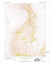
Other maps of this area

1931 · Lovelock
USGS Topo · 1:250,000

1932 · Sonoma Range
USGS Topo · 1:250,000

1935 · Lovelock
USGS Topo · 1:250,000

1939 · Sonoma Range
USGS Topo · 1:250,000

1939 · Eugene Mountains Area
USGS Topo · 1:62,500

1942 · Eugene Mountains Area
USGS Topo · 1:62,500

1954 · Unionville
USGS Topo · 1:62,500

1955 · Lovelock
USGS Topo · 1:250,000

1955 · Winnemucca
USGS Topo · 1:250,000

1956 · Imlay
USGS Topo · 1:62,500