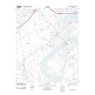
2011 Map of Dunaway Mountain
USGS Topo · Published 2011About this map
H Neely Henry Lake and the winding course of Big Wills Creek dominate this 2011 survey, showing the complex interplay between the Coosa River's impounded waters and the surrounding hills. The landscape is marked by prominent high points such as Dunaway Mountain, Hopewell Mountain, and Hensley Mountain, which frame a mix of established residential areas and rural corridors. Near the northern border, Siberton and the Gadsden Municipal Airport reflect the area's logistical importance, while the Attalla Speedway sits just west of Dry Creek.
Find a feature on this map
200 named features on this map. Tap any name to fly to it.
Don’t see what you’re looking for? This feature index may not catch every label — zoom into the map to look around manually.
Map Details
Editions of this 2011 Dunaway Mountain Map
This is the sole edition of this map. No revisions or reprints were ever made.
Other maps of this area

1885 · Gadsden
USGS Topo · 1:125,000

1888 · Gadsden
USGS Topo · 1:125,000

1889 · Springville
USGS Topo · 1:125,000

1892 · Springville
USGS Topo · 1:125,000

1892 · Gadsden
USGS Topo · 1:125,000

1893 · Fort Payne
USGS Topo · 1:125,000

1895 · Gadsden
USGS Topo · 1:125,000

1898 · Fort Payne
USGS Topo · 1:125,000

1900 · Fort Payne
USGS Topo · 1:125,000

1900 · Anniston
USGS Topo · 1:125,000