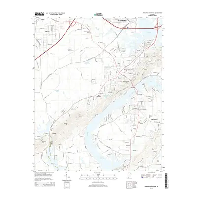
2014 Map of Dunaway Mountain
USGS Topo · Published 2014About this map
H Neely Henry Lake and the Coosa River dominate this portion of the Alabama landscape, framing the industrial and residential expansion south of Gadsden. The map documents the developed corridors of Rainbow City and Southside, where suburban growth meets the rugged elevations of Dunaway Mtn and Hensley Mtn. The Northeast Alabama Regional Airport stands as a significant landmark in the northern section, while smaller water bodies like Château Charolais Lake and Cardwell Lake are tucked into the residential fabric.
Find a feature on this map
234 named features on this map. Tap any name to fly to it.
Don’t see what you’re looking for? This feature index may not catch every label — zoom into the map to look around manually.
Map Details
Editions of this 2014 Dunaway Mountain Map
This is the sole edition of this map. No revisions or reprints were ever made.
Other maps of this area

1885 · Gadsden
USGS Topo · 1:125,000

1888 · Gadsden
USGS Topo · 1:125,000

1889 · Springville
USGS Topo · 1:125,000

1892 · Springville
USGS Topo · 1:125,000

1892 · Gadsden
USGS Topo · 1:125,000

1893 · Fort Payne
USGS Topo · 1:125,000

1895 · Gadsden
USGS Topo · 1:125,000

1898 · Fort Payne
USGS Topo · 1:125,000

1900 · Fort Payne
USGS Topo · 1:125,000

1900 · Anniston
USGS Topo · 1:125,000