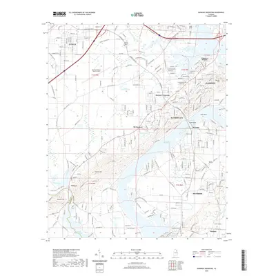
2020 Map of Dunaway Mountain
USGS Topo · Published 2020About this map
H Neely Henry Lake and the meandering course of Big Wills Creek define the landscape south of Attalla in this modern survey. The map documents the extensive residential and industrial development connecting several municipalities, including Rainbow City, Southside, and the western reaches of Gadsden. Significant infrastructure is visible, from the Northeast Alabama Regional Airport to the path of the Alabama & Tennessee River RR. Local history is anchored by landmarks like Dunaway Mtn and the Pilgrims Rest Cem. The map illustrates a contemporary suburban-industrial corridor where smaller communities like Morgans Crossroads and Old Harmony have been integrated into the larger metropolitan footprint, while natural features like Hopewell Mtn still rise above the river valley.
Find a feature on this map
242 named features on this map. Tap any name to fly to it.
Don’t see what you’re looking for? This feature index may not catch every label — zoom into the map to look around manually.
Map Details
Editions of this 2020 Dunaway Mountain Map
This is the sole edition of this map. No revisions or reprints were ever made.
Other maps of this area

1885 · Gadsden
USGS Topo · 1:125,000

1888 · Gadsden
USGS Topo · 1:125,000

1889 · Springville
USGS Topo · 1:125,000

1892 · Springville
USGS Topo · 1:125,000

1892 · Gadsden
USGS Topo · 1:125,000

1893 · Fort Payne
USGS Topo · 1:125,000

1895 · Gadsden
USGS Topo · 1:125,000

1898 · Fort Payne
USGS Topo · 1:125,000

1900 · Fort Payne
USGS Topo · 1:125,000

1900 · Anniston
USGS Topo · 1:125,000