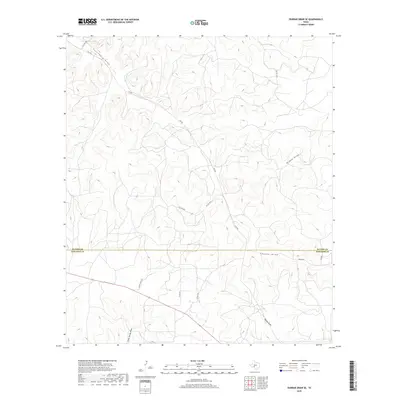
2019 Map of Dunbar Draw SE
USGS Topo · Published 2019About this map
The high plateau of the Edwards Plateau is etched by a series of dry drainages in this rural corner of West Texas. The boundary between Sutton and Edwards Counties bisects the landscape, which is defined by significant topographical relief as the land drops into various draws. Principal among these is Cusenbary Draw in the northwest and McKee Draw to the east, while Coyote Draw and Wheat Draw dominate the southern portion of the sheet. The transportation network is sparse and largely composed of private ranch roads, such as Pvt Rd 3324 and Fagan Ranch Rd, reflecting the remote, large-acreage ranching heritage of the region. Distinctive local markers like Broadway and 5th Ave appear as named thoroughfares within this expansive, undeveloped terrain.
Find a feature on this map
16 named features on this map. Tap any name to fly to it.
Don’t see what you’re looking for? This feature index may not catch every label — zoom into the map to look around manually.
Map Details
Editions of this 2019 Dunbar Draw SE Map
This is the sole edition of this map. No revisions or reprints were ever made.
Other maps of this area

1893 · Rock Springs
USGS Topo · 1:125,000

1954 · Sonora
USGS Topo · 1:250,000

1958 · Sonora
USGS Topo · 1:250,000

1963 · Steen Lake
USGS Topo · 1:24,000

1963 · Harrison Ranch
USGS Topo · 1:24,000

1967 · Dunbar Draw SW
USGS Topo · 1:24,000

1967 · Dunbar Draw NW
USGS Topo · 1:24,000

1967 · Dunbar Draw NE
USGS Topo · 1:24,000

1967 · Dunbar Draw SE
USGS Topo · 1:24,000

1970 · Ray Lake NW
USGS Topo · 1:24,000