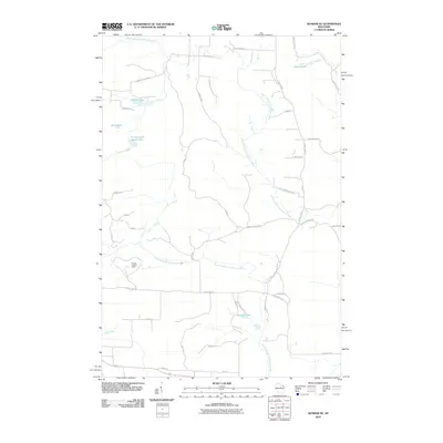
2010 Map of Dunbar NE
USGS Topo · Published 2010About this map
The North Branch Pemebonwon River and South Branch Pemebonwon River converge within this northern Wisconsin landscape, defining a region shaped by its glacial hydrology. The terrain is dotted with numerous small bodies of water, including Barlow Lake, Belgian Lake, and the connected Johnson and Beach Lake. This 2010 survey illustrates a modern rural infrastructure where named forest roads like Camp 12 Rd and Cook and Bullets Rd penetrate the thick woodland. A primary landmark for navigation and historical forestry management is the Dunbar Lookout Tower, situated near the headwaters of local drainages like Crossett Creek. The map provides a clear picture of the township's layout, showing the transition from established routes like County Hwy O to the intricate network of fire lanes and logging roads that facilitate access to the surrounding river basins.
Find a feature on this map
41 named features on this map. Tap any name to fly to it.
Don’t see what you’re looking for? This feature index may not catch every label — zoom into the map to look around manually.
Map Details
Editions of this 2010 Dunbar NE Map
This is the sole edition of this map. No revisions or reprints were ever made.
Other maps of this area

1939 · Pembine
USGS Topo · 1:48,000

1939 · Dunbar
USGS Topo · 1:48,000

1939 · Iron Mountain
USGS Topo · 1:48,000

1941 · Dunbar
USGS Topo · 1:48,000

1941 · Iron Mountain
USGS Topo · 1:48,000

1947 · Pembine
USGS Topo · 1:48,000

1947 · Dunbar
USGS Topo · 1:48,000

1947 · Iron Mountain
USGS Topo · 1:48,000

1954 · Iron Mountain
USGS Topo · 1:250,000

1954 · Escanaba
USGS Topo · 1:250,000