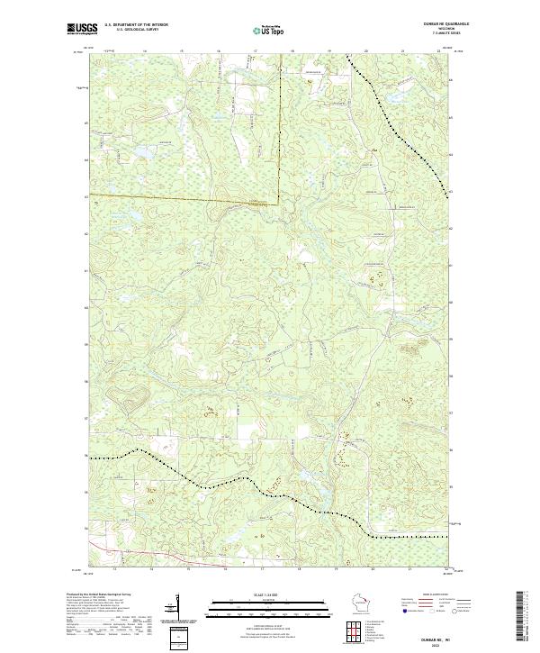
2022 Map of Dunbar NE
USGS Topo · Published 2022About this map
The N Br Pemebonwon River and S Br Pemebonwon River dominate this section of the Wisconsin Northwoods, where the landscape is defined by the hydrologic patterns of the border between Florence and Marinette counties. The terrain is densely packed with glacial water bodies, from the clear waters of Belgian Lake and Barlow Lake to smaller features like No Bottom Lake and Mud Lake. A complex network of logging and forest roads, including Forest Rd 533 and Forest Rd 1001, provides access to these timberlands and remote fishing spots. Named local landmarks like Cook and Bullets and Johnson and Beach Lake reflect the recreational and social character of the region, while drainage ways such as Crossett Cr and Spikehorn Cr feed the larger river branches.
Find a feature on this map
65 named features on this map. Tap any name to fly to it.
Don’t see what you’re looking for? This feature index may not catch every label — zoom into the map to look around manually.
Map Details
Editions of this 2022 Dunbar NE Map
This is the sole edition of this map. No revisions or reprints were ever made.
Other maps of this area

1939 · Pembine
USGS Topo · 1:48,000

1939 · Dunbar
USGS Topo · 1:48,000

1939 · Iron Mountain
USGS Topo · 1:48,000

1941 · Dunbar
USGS Topo · 1:48,000

1941 · Iron Mountain
USGS Topo · 1:48,000

1947 · Pembine
USGS Topo · 1:48,000

1947 · Dunbar
USGS Topo · 1:48,000

1947 · Iron Mountain
USGS Topo · 1:48,000

1954 · Iron Mountain
USGS Topo · 1:250,000

1954 · Escanaba
USGS Topo · 1:250,000