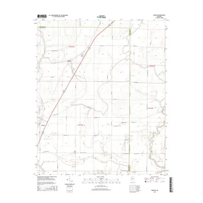
2015 Map of Duncan
USGS Topo · Published 2015About this map
The low-lying Delta landscape of Bolivar and Coahoma counties is defined here by an intricate network of slow-moving water and agricultural roads. The town of Duncan and the village of Alligator serve as the primary hubs, situated near the western edge of the quadrangle. This area reflects the deep-rooted rural character of the Mississippi Delta, where the land is carved by the Hushpuckena River and the Big Sunflower River. The map reveals a high density of family and community burial grounds, such as Mount-Harmon Cem, Union Temple Cem, and Mount Evergreen Cem, which are essential markers for genealogical research in this region.
Find a feature on this map
60 named features on this map. Tap any name to fly to it.
Don’t see what you’re looking for? This feature index may not catch every label — zoom into the map to look around manually.
Map Details
Editions of this 2015 Duncan Map
This is the sole edition of this map. No revisions or reprints were ever made.
Other maps of this area

1930 · Mellwood
USGS Topo · 1:62,500

1931 · Drew
USGS Topo · 1:48,000

1935 · Clarksdale
USGS Topo · 1:62,500

1935 · Mound Bayou
USGS Topo · 1:62,500

1939 · Pace
USGS Topo · 1:62,500

1939 · Clarksdale
USGS Topo · 1:62,500

1939 · Mellwood
USGS Topo · 1:62,500

1948 · Helena
USGS Topo · 1:250,000

1950 · Helena
USGS Topo · 1:250,000

1953 · Greenwood
USGS Topo · 1:250,000