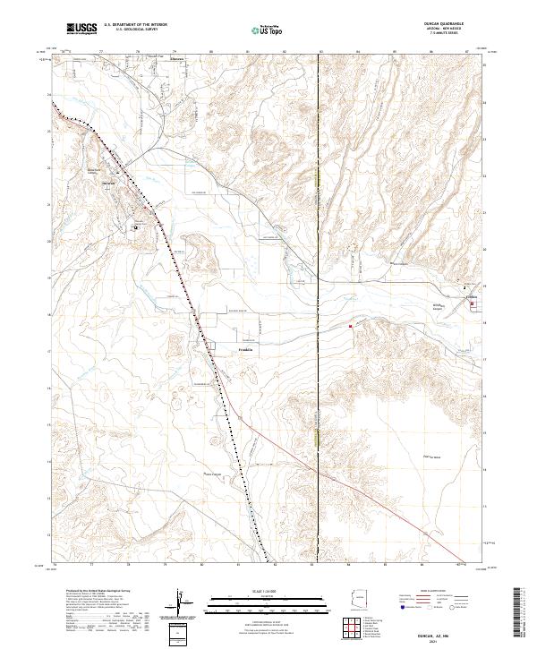
2021 Map of Duncan
USGS Topo · Published 2021About this map
The Gila River corridor serves as the primary artery for settlement and agriculture in this borderland region between Arizona and New Mexico. The town of Duncan sits along the northern banks, while Franklin and Virden lie further southeast, connected by the historical routing of Old US Hwy 70. A sophisticated irrigation network, including the New Model Canal, Sunset Canal, and Valley Canal, draws from the river to support the valley floors beneath the high plateaus of Pearson Mesa and Hunter Flat.
Find a feature on this map
67 named features on this map. Tap any name to fly to it.
Don’t see what you’re looking for? This feature index may not catch every label — zoom into the map to look around manually.
Map Details
Editions of this 2021 Duncan Map
This is the sole edition of this map. No revisions or reprints were ever made.
Other maps of this area

1954 · Silver City
USGS Topo · 1:250,000

1958 · Silver City
USGS Topo · 1:250,000

1959 · Steeple Rock
USGS Topo · 1:62,500

1959 · Canador Peak
USGS Topo · 1:62,500

1959 · York Valley
USGS Topo · 1:62,500

1960 · Duncan
USGS Topo · 1:62,500

1962 · Silver City
USGS Topo · 1:250,000
1986 · Sheldon
USGS Topo · 1:24,000
1986 · Duncan
USGS Topo · 1:24,000
1986 · Hot Well
USGS Topo · 1:24,000