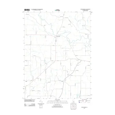
2012 Map of Duncan Mills
USGS Topo · Published 2012About this map
Duncan Mills serves as the focal point of this Illinois survey, situated where the terrain meets the winding course of the Spoon River. This portion of Fulton County is characterized by a network of rural roads connecting small residential clusters and farming operations, such as Enion to the south and the agricultural footprint of Atchley Farms in the northeast. The geography is defined by the valley of the Spoon River, which influences the local road layout and the distribution of smaller communities. A modern US Topo sheet, this map provides a clear look at the contemporary landscape of Central Illinois, showing the persistent rural character of these river-side settlements and the established infrastructure of the early twenty-first century.
Find a feature on this map
3 named features on this map. Tap any name to fly to it.
Don’t see what you’re looking for? This feature index may not catch every label — zoom into the map to look around manually.
Map Details
Editions of this 2012 Duncan Mills Map
This is the sole edition of this map. No revisions or reprints were ever made.
Other maps of this area

1918 · Vermont
USGS Topo · 1:62,500

1921 · Vermont
USGS Topo · 1:62,500

1925 · Havana
USGS Topo · 1:62,500

1926 · Beardstown
USGS Topo · 1:62,500

1930 · Chandlerville
USGS Topo · 1:62,500

1932 · Chandlerville
USGS Topo · 1:62,500

1944 · Beardstown
USGS Topo · 1:62,500

1947 · Lewistown
USGS Topo · 1:24,000

1947 · St. David
USGS Topo · 1:24,000

1947 · Havana
USGS Topo · 1:24,000