2022 Map of Duncanville
USGS Topo · Published 2022About this map
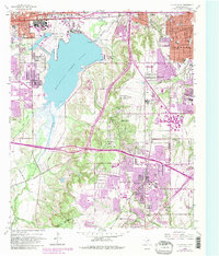
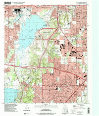
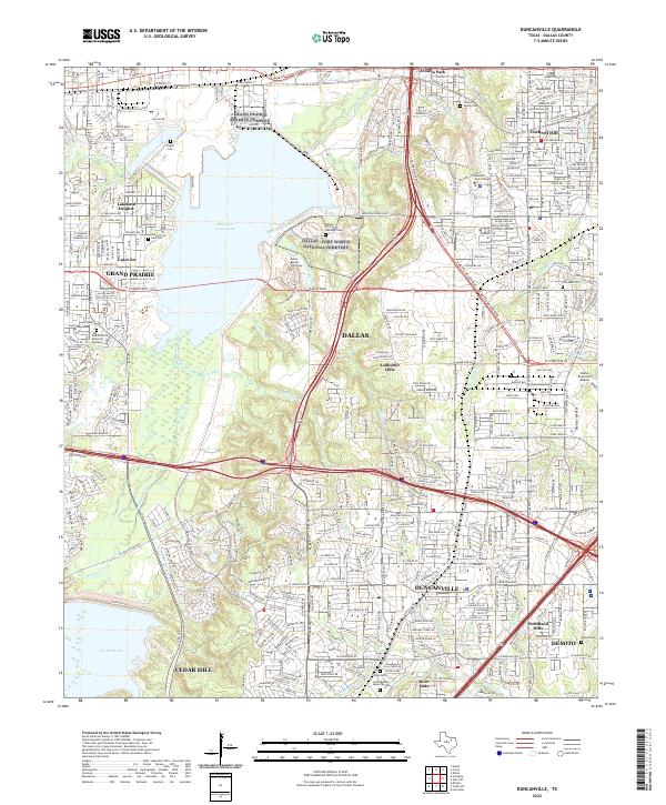
Mountain Creek Lake and the northern reaches of Joe Pool Lake anchor this modern-era study of the Dallas suburbs, showing the heavy infrastructure and complex hydrology of the region. The landscape is defined by the convergence of major transportation corridors like S Walton Walker Blvd and the S Santa Fe Trl, which navigate the drainages of Fivemile Cr and Tenmile Cr. Local history and genealogy are represented by several traditional burial grounds including Fugitt Cem, Daniel Cem, and Antioch Life Park Cem, which sit alongside institutional landmarks such as Dallas Baptist University and Mountain View College. The presence of the Dallas Naval Air Station and the Dallas Executive Airport highlights the area's long-standing connection to aviation and national defense in the Duncanville and Grand Prairie corridor.
Find a feature on this map
56 named features on this map. Tap any name to fly to it.
Don’t see what you’re looking for? This feature index may not catch every label — zoom into the map to look around manually.
Map Details
Editions of this 2022 Duncanville Map
This is the sole edition of this map. No revisions or reprints were ever made.
Historical Maps of Arcadia Park Through Time
3 maps found