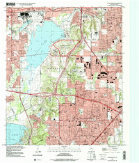
1995 Map of Duncanville
USGS Topo · Published 2001About this map
Mountain Creek Lake dominates this mid-1990s landscape, serving as a focal point for heavy industry and suburban expansion southwest of Dallas. The shoreline is heavily utilized, featuring the Naval Weapons Industrial Reserve Plant and the Mountain Creek Power Plant. The era's development is evidenced by the growing residential footprints of Duncanville and De Soto, alongside large-scale commercial hubs like the Southwest Center Mall.
Find a feature on this map
101 named features on this map. Tap any name to fly to it.
Don’t see what you’re looking for? This feature index may not catch every label — zoom into the map to look around manually.
Map Details
Editions of this 1995 Duncanville Map
This is the sole edition of this map. No revisions or reprints were ever made.
Other maps of this area

1891 · Dallas
USGS Topo · 1:125,000

1893 · Dallas
USGS Topo · 1:125,000

1894 · Fort Worth
USGS Topo · 1:125,000

1931 · Carrollton
USGS Topo · 1:62,500

1931 · Grapevine
USGS Topo · 1:62,500

1954 · Dallas
USGS Topo · 1:250,000

1958 · Dallas
USGS Topo · 1:250,000

1958 · Oak Cliff
USGS Topo · 1:24,000

1958 · Dallas
USGS Topo · 1:24,000

1959 · Arlington
USGS Topo · 1:24,000