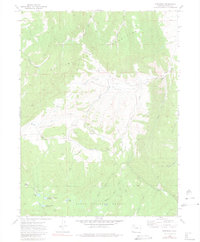
1971 Map of Dunckley
USGS Topo · Published 1980About this map
Routt National Forest dominates the southern landscape of this 1971 survey, where the rugged topography of the Williams Fork mountains gives way to the open basin of Williams Park. The settlement at Dunckley serves as a central point in an area defined by water management and resource extraction, featuring several irrigation canals like the Williams Park Ditch and No 2 Ditch. These waterways support the livestock and agricultural efforts visible at Dubeau Meadow, while a network of reservoirs including Shaffer Res, Dunckley and Dubeau Reservoir, and Sellers-Crowell Reservoir manages the snowmelt from the surrounding peaks.
Find a feature on this map
37 named features on this map. Tap any name to fly to it.
Don’t see what you’re looking for? This feature index may not catch every label — zoom into the map to look around manually.
Map Details
Editions of this 1971 Dunckley Map
3 editions found
Other maps of this area

1916 · Daton Peak
USGS Topo · 1:62,500

1920 · Daton Peak
USGS Topo · 1:62,500

1924 · Mt. Harris
USGS Topo · 1:48,000

1926 · Mount Harris
USGS Topo · 1:62,500

1954 · Craig
USGS Topo · 1:250,000

1957 · Craig
USGS Topo · 1:250,000

1958 · Craig
USGS Topo · 1:250,000

1960 · Craig
USGS Topo · 1:250,000

1962 · Craig
USGS Topo · 1:250,000

1964 · Craig
USGS Topo · 1:250,000