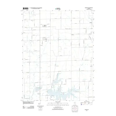
2012 Map of Dundas
USGS Topo · Published 2012About this map
The Fox River meanders southward through this section of Richland County, defining the drainage patterns for numerous small tributaries like Coon Cr and Jack Oak Cr. This rural landscape is anchored by the community of Dundas, which features a Post Office and the nearby Dundas Cem, while the settlement of West Liberty sits at the northern edge of the survey. The southern portion of the map is dominated by the expansive East Fork Lake, a significant reservoir that encompasses several smaller bodies of water including Vernor Lake and Olney Lake.
Find a feature on this map
95 named features on this map. Tap any name to fly to it.
Don’t see what you’re looking for? This feature index may not catch every label — zoom into the map to look around manually.
Map Details
Editions of this 2012 Dundas Map
This is the sole edition of this map. No revisions or reprints were ever made.
Other maps of this area

1910 · Hardinville
USGS Topo · 1:62,500

1911 · Sumner
USGS Topo · 1:62,500

1913 · Sumner
USGS Topo · 1:62,500

1941 · Newton
USGS Topo · 1:62,500

1943 · Newton
USGS Topo · 1:62,500

1949 · Olney
USGS Topo · 1:62,500

1956 · Vincennes
USGS Topo · 1:250,000

1957 · Vincennes
USGS Topo · 1:250,000

1958 · Vincennes
USGS Topo · 1:250,000

1958 · Belleville
USGS Topo · 1:250,000