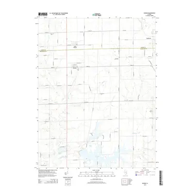
2015 Map of Dundas
USGS Topo · Published 2015About this map
The Fox River valley and its surrounding agricultural plains define the landscape along the Jasper Co and Richland Co border. Small rural communities like West Liberty and Dundas anchor the township grid, which is dotted with historical burial grounds including Bethel Cem, Dundas Cem, and the Saint Pauls Lutheran Cem. To the south, the expansion of the East Fork Lake reservoir system creates a jagged shoreline where the waters of the E Fork Fox River and Calfkiller Cr gather. This area exhibits a typical Illinois Midwestern pattern of rectilinear county roads like Mt Gilead Ln and Dundas Ln that give way to the more organic contours of the lake district and the winding course of Long Br. Local genealogists will find several rural cemeteries, such as Springtown Cem and Saron Cem, marking the early settlement hubs of the region.
Find a feature on this map
71 named features on this map. Tap any name to fly to it.
Don’t see what you’re looking for? This feature index may not catch every label — zoom into the map to look around manually.
Map Details
Editions of this 2015 Dundas Map
This is the sole edition of this map. No revisions or reprints were ever made.
Other maps of this area

1910 · Hardinville
USGS Topo · 1:62,500

1911 · Sumner
USGS Topo · 1:62,500

1913 · Sumner
USGS Topo · 1:62,500

1941 · Newton
USGS Topo · 1:62,500

1943 · Newton
USGS Topo · 1:62,500

1949 · Olney
USGS Topo · 1:62,500

1956 · Vincennes
USGS Topo · 1:250,000

1957 · Vincennes
USGS Topo · 1:250,000

1958 · Vincennes
USGS Topo · 1:250,000

1958 · Belleville
USGS Topo · 1:250,000