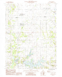
1985 Map of Dundas
USGS Topo · Published 1985About this map
West Liberty and the settlement of Dundas anchor this mid-1980s landscape at the border of Jasper and Richland counties. The area is defined by a dense network of watercourses, where the Fox River meets tributaries like Cooks Creek, Camp Branch, and Long Branch. The southern portion of the map reveals significant recreational and utility infrastructure, notably the sizable Olney Lake and Vernor Lake, complemented by a Golf Course, Campground, and a Boat Ramp.
Find a feature on this map
29 named features on this map. Tap any name to fly to it.
Don’t see what you’re looking for? This feature index may not catch every label — zoom into the map to look around manually.
Map Details
Editions of this 1985 Dundas Map
This is the sole edition of this map. No revisions or reprints were ever made.
Other maps of this area

1910 · Hardinville
USGS Topo · 1:62,500

1911 · Sumner
USGS Topo · 1:62,500

1913 · Sumner
USGS Topo · 1:62,500

1941 · Newton
USGS Topo · 1:62,500

1943 · Newton
USGS Topo · 1:62,500

1949 · Olney
USGS Topo · 1:62,500

1956 · Vincennes
USGS Topo · 1:250,000

1957 · Vincennes
USGS Topo · 1:250,000

1958 · Vincennes
USGS Topo · 1:250,000

1958 · Belleville
USGS Topo · 1:250,000