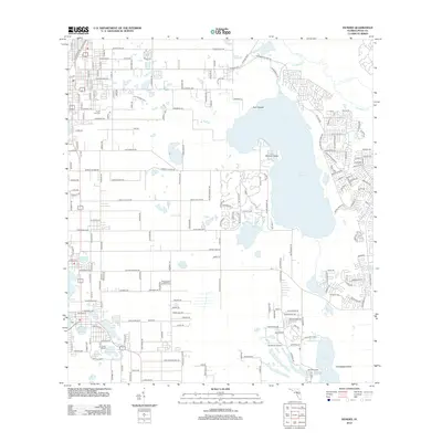
2012 Map of Dundee
USGS Topo · Published 2012About this map
The waters of Lake Marion and Lake Pierce dominate this portion of Polk County, where the landscape is defined by an intricate network of interconnected basins and wetlands. Central to the area, Bannon Island and the Twin Islands break the surface of Lake Marion, while to the south, Snodgrass Island sits within the depths of Lake Pierce. This survey shows the residential growth patterns characteristic of the early 21st century, with dense subdivisions and established street grids like those near Lake Eva and Crystal Lake contrasting with more open lakeside tracts.
Find a feature on this map
216 named features on this map. Tap any name to fly to it.
Don’t see what you’re looking for? This feature index may not catch every label — zoom into the map to look around manually.
Map Details
Editions of this 2012 Dundee Map
This is the sole edition of this map. No revisions or reprints were ever made.
Other maps of this area

1952 · Lake Wales
USGS Topo · 1:24,000

1952 · Hesperides
USGS Topo · 1:24,000

1953 · Dundee
USGS Topo · 1:24,000

1953 · Lake Hatchineha
USGS Topo · 1:24,000

1953 · Lake Tohopekaliga
USGS Topo · 1:24,000

1953 · Davenport
USGS Topo · 1:24,000

1955 · Eloise
USGS Topo · 1:24,000

1955 · Orlando
USGS Topo · 1:250,000

1956 · Fort Pierce
USGS Topo · 1:250,000

1957 · Orlando
USGS Topo · 1:250,000