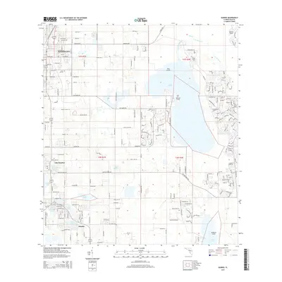
2015 Map of Dundee
USGS Topo · Published 2015About this map
The lake-dotted ridge of Central Florida’s citrus belt is defined by a dense concentration of interior waters and developing municipalities. Haines City anchors the north, with the Forest Hill Cem providing a notable genealogical landmark for the region. The landscape transitions southward through Lake Hamilton into the township of Dundee, where the residential grid is constrained by numerous natural basins including Lake Ruth, Lake Marie, and Lake Menzie. This area, historically vital for its grove production, shows a complex network of local roads like Kokomo Rd and Lake Hatchineha Rd that navigate around the extensive wetland systems of Lake Marion and its primary drainage, Lake Marion Cr. Notable landforms such as Bannon Island and Snodgrass Island emerge from the surrounding aquatic landscape, illustrating the unique topography of Polk County's lake-and-prairie environment.
Find a feature on this map
86 named features on this map. Tap any name to fly to it.
Don’t see what you’re looking for? This feature index may not catch every label — zoom into the map to look around manually.
Map Details
Editions of this 2015 Dundee Map
This is the sole edition of this map. No revisions or reprints were ever made.
Other maps of this area

1952 · Lake Wales
USGS Topo · 1:24,000

1952 · Hesperides
USGS Topo · 1:24,000

1953 · Dundee
USGS Topo · 1:24,000

1953 · Lake Hatchineha
USGS Topo · 1:24,000

1953 · Lake Tohopekaliga
USGS Topo · 1:24,000

1953 · Davenport
USGS Topo · 1:24,000

1955 · Eloise
USGS Topo · 1:24,000

1955 · Orlando
USGS Topo · 1:250,000

1956 · Fort Pierce
USGS Topo · 1:250,000

1957 · Orlando
USGS Topo · 1:250,000