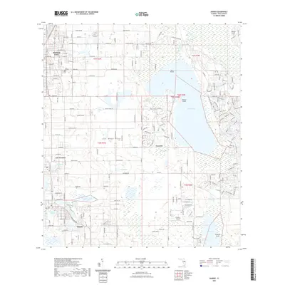
2021 Map of Dundee
USGS Topo · Published 2021About this map
Lake Marion dominates the eastern half of this landscape, its waters broken by Bannon Island and the smaller Twin Islands. The terrain is defined by the Lake Wales Ridge, which runs through the center of the region, influencing the placement of settlements and transport routes. To the west, the growing communities of Haines City, Lake Hamilton, and Dundee are interconnected by a dense network of roads such as the Scenic Hwy and Co Rd 544.
Find a feature on this map
136 named features on this map. Tap any name to fly to it.
Don’t see what you’re looking for? This feature index may not catch every label — zoom into the map to look around manually.
Map Details
Editions of this 2021 Dundee Map
This is the sole edition of this map. No revisions or reprints were ever made.
Other maps of this area

1952 · Lake Wales
USGS Topo · 1:24,000

1952 · Hesperides
USGS Topo · 1:24,000

1953 · Dundee
USGS Topo · 1:24,000

1953 · Lake Hatchineha
USGS Topo · 1:24,000

1953 · Lake Tohopekaliga
USGS Topo · 1:24,000

1953 · Davenport
USGS Topo · 1:24,000

1955 · Eloise
USGS Topo · 1:24,000

1955 · Orlando
USGS Topo · 1:250,000

1956 · Fort Pierce
USGS Topo · 1:250,000

1957 · Orlando
USGS Topo · 1:250,000