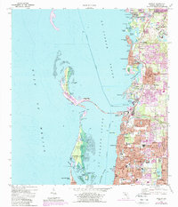
1974 Map of Dunedin
USGS Topo · Published 1988About this map
St Joseph Sound serves as the focal point for this coastal Florida landscape, separating the developing mainland from the barrier chain of Honeymoon Island and Caladesi Island. The 1970s and 1980s growth of Dunedin is visible in the dense street grids and burgeoning neighborhoods like Dunedin Isles. The Dunedin Causeway provides a critical link to the Honeymoon Island State Recreation Area, reflecting the region's mid-century shift toward coastal tourism and preservation.
Find a feature on this map
69 named features on this map. Tap any name to fly to it.
Don’t see what you’re looking for? This feature index may not catch every label — zoom into the map to look around manually.
Map Details
Editions of this 1974 Dunedin Map
3 editions found
Other maps of this area

1921 · Sand Key
USGS Topo · 1:62,500

1921 · St Petersburg
USGS Topo · 1:62,500

1943 · Safety Harbor
USGS Topo · 1:31,680

1943 · Dunedin
USGS Topo · 1:31,680

1943 · Tarpon Springs
USGS Topo · 1:31,680

1943 · Clearwater
USGS Topo · 1:24,000

1943 · Elfers
USGS Topo · 1:24,000

1943 · Oldsmar
USGS Topo · 1:24,000

1944 · Elfers
USGS Topo · 1:31,680

1944 · Oldsmar
USGS Topo · 1:31,680