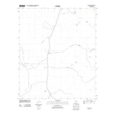
2010 Map of Dunken
USGS Topo · Published 2010About this map
The high plains of Chaves County are defined by seasonal water sources and isolated ranching operations in this 2010 survey. Dunken serves as a central junction, where Drunken Well Rd meets the path through Big Cherry Canyon. The landscape is etched with drainage systems like Rio Peñasco and Bluewater Creek, which supported the early development of the region's livestock industry.
Find a feature on this map
23 named features on this map. Tap any name to fly to it.
Don’t see what you’re looking for? This feature index may not catch every label — zoom into the map to look around manually.
Map Details
Editions of this 2010 Dunken Map
This is the sole edition of this map. No revisions or reprints were ever made.
Other maps of this area

1954 · Carlsbad
USGS Topo · 1:250,000

1958 · Carlsbad
USGS Topo · 1:250,000

1962 · Dunken
USGS Topo · 1:62,500

1963 · Robertson Canyon
USGS Topo · 1:24,000
1963 · Elk
USGS Topo · 1:24,000

1965 · Lewis Peak NE
USGS Topo · 1:24,000

1965 · Chimney Lake
USGS Topo · 1:24,000

1965 · Lewis Peak
USGS Topo · 1:24,000

1979 · Alamogordo
USGS Topo · 1:100,000
1989 · Dunken
USGS Topo · 1:24,000