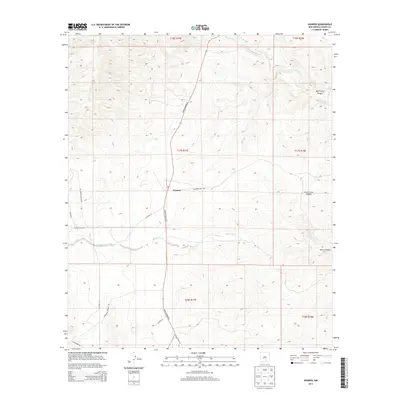
2013 Map of Dunken
USGS Topo · Published 2013About this map
Dunken occupies a central position in this Chaves County landscape, situated at the intersection of Pinion Dunken Rd and Drunken Well Rd. This remote high-desert region is defined by a series of deep drainage systems, including the northern sweep of Rio Peñasco and the eastward flow of Bluewater Creek. The terrain is deeply incised by family-named landmarks and ranch-access routes such as Champion Canyon Rd and Cauape Ranch Rd.
Find a feature on this map
24 named features on this map. Tap any name to fly to it.
Don’t see what you’re looking for? This feature index may not catch every label — zoom into the map to look around manually.
Map Details
Editions of this 2013 Dunken Map
This is the sole edition of this map. No revisions or reprints were ever made.
Other maps of this area

1954 · Carlsbad
USGS Topo · 1:250,000

1958 · Carlsbad
USGS Topo · 1:250,000

1962 · Dunken
USGS Topo · 1:62,500

1963 · Robertson Canyon
USGS Topo · 1:24,000
1963 · Elk
USGS Topo · 1:24,000

1965 · Lewis Peak NE
USGS Topo · 1:24,000

1965 · Chimney Lake
USGS Topo · 1:24,000

1965 · Lewis Peak
USGS Topo · 1:24,000

1979 · Alamogordo
USGS Topo · 1:100,000
1989 · Dunken
USGS Topo · 1:24,000