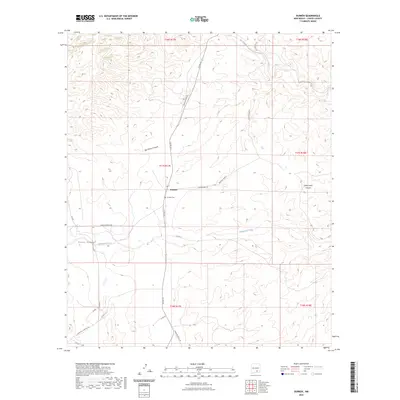
2023 Map of Dunken
USGS Topo · Published 2023About this map
Dunken sits at the heart of this Chaves County landscape, where the high desert terrain is defined by an intricate network of drainage systems and ranch roads. The settlement is anchored by the Dunken Cem, providing a focal point for genealogical research in this sparsely populated region. The topography is dominated by significant geographic features like Big Cherry Canyon and the winding course of the Rio Peñasco in the northeast corner. This modern survey illustrates how long-established ranching interests continue to shape the land, evidenced by named thoroughfares such as Jennings Ranch Rd and Cauhape Ranch Rd. Water remains the critical factor for life here, with Bluewater Creek cutting through the center and various wells, including those reached by Dunken Well Rd, marking the map. The elevation transitions are captured through several named canyons, including Cuevo Canyon and its smaller neighbor, Little Cuevo Canyon.
Find a feature on this map
24 named features on this map. Tap any name to fly to it.
Don’t see what you’re looking for? This feature index may not catch every label — zoom into the map to look around manually.
Map Details
Editions of this 2023 Dunken Map
This is the sole edition of this map. No revisions or reprints were ever made.
Other maps of this area

1954 · Carlsbad
USGS Topo · 1:250,000

1958 · Carlsbad
USGS Topo · 1:250,000

1962 · Dunken
USGS Topo · 1:62,500

1963 · Robertson Canyon
USGS Topo · 1:24,000
1963 · Elk
USGS Topo · 1:24,000

1965 · Lewis Peak NE
USGS Topo · 1:24,000

1965 · Chimney Lake
USGS Topo · 1:24,000

1965 · Lewis Peak
USGS Topo · 1:24,000

1979 · Alamogordo
USGS Topo · 1:100,000
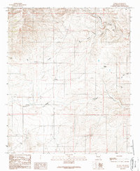
1989 · Dunken
USGS Topo · 1:24,000