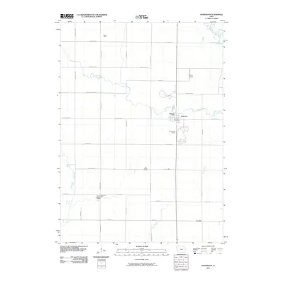
2010 Map of Dunkerton
USGS Topo · Published 2010About this map
Crane Creek and Poyner Creek wind through this Black Hawk County landscape, defining the rural character of the region as it appeared in the early 21st century. The town of Dunkerton serves as a central hub, where the Dunkerton Post Office and the Dunkerton Bridge mark the intersection of local commerce and infrastructure. To the north, the Wapsipinicon River clips the corner of the survey, highlighting the area's place within the larger drainage system of northeast Iowa.
Find a feature on this map
31 named features on this map. Tap any name to fly to it.
Don’t see what you’re looking for? This feature index may not catch every label — zoom into the map to look around manually.
Map Details
Editions of this 2010 Dunkerton Map
This is the sole edition of this map. No revisions or reprints were ever made.
Other maps of this area

1954 · Waterloo
USGS Topo · 1:250,000

1955 · Waterloo
USGS Topo · 1:250,000

1963 · Denver
USGS Topo · 1:24,000

1963 · Waterloo South
USGS Topo · 1:24,000

1963 · Waterloo North
USGS Topo · 1:24,000

1971 · Readlyn
USGS Topo · 1:24,000

1971 · Gilbertville
USGS Topo · 1:24,000

1971 · Dunkerton
USGS Topo · 1:24,000

1971 · Fairbank
USGS Topo · 1:24,000

1971 · Littleton
USGS Topo · 1:24,000