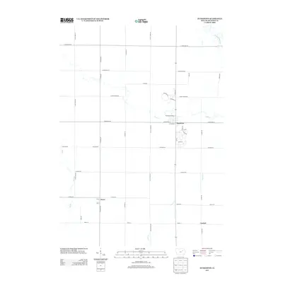
2013 Map of Dunkerton
USGS Topo · Published 2013About this map
Dunkerton serves as the primary hub of this eastern Black Hawk County landscape, situated where Crane Cr winds toward the larger Wapsipinicon River in the northeast corner. The settlement pattern reflects a deeply established agricultural grid, punctuated by the smaller communities of Dewar and Canfield. The presence of the Dunkerton Bridge and a network of arterial roads like E Cedar Wapsi Rd and E Airline Hwy highlights the importance of local connectivity between these farming townships. While the larger waterways define the drainage of the area, smaller streams like Poyner Cr and Elk Run thread through the sections, shaping the placement of rural homesteads and local roads in this quintessential Iowa prairie environment during the early 21st century.
Find a feature on this map
38 named features on this map. Tap any name to fly to it.
Don’t see what you’re looking for? This feature index may not catch every label — zoom into the map to look around manually.
Map Details
Editions of this 2013 Dunkerton Map
This is the sole edition of this map. No revisions or reprints were ever made.
Other maps of this area

1954 · Waterloo
USGS Topo · 1:250,000

1955 · Waterloo
USGS Topo · 1:250,000

1963 · Denver
USGS Topo · 1:24,000

1963 · Waterloo South
USGS Topo · 1:24,000

1963 · Waterloo North
USGS Topo · 1:24,000

1971 · Readlyn
USGS Topo · 1:24,000

1971 · Gilbertville
USGS Topo · 1:24,000

1971 · Dunkerton
USGS Topo · 1:24,000

1971 · Fairbank
USGS Topo · 1:24,000

1971 · Littleton
USGS Topo · 1:24,000