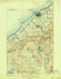
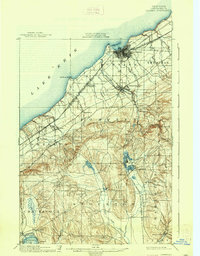
1900 Map of Dunkirk
USGS Topo · Published 1945About this map
Lake Erie defines the northern shoreline of this survey, where the major port and industrial hub of Dunkirk anchors a complex network of late 19th-century rail infrastructure. The convergence of lines like the L. S. and M. S. R. R. and the Erie R. R. through the city and nearby Fredonia illustrates the region's importance as a transportation corridor connecting New York and Pennsylvania. Moving inland from the lake, the terrain rises into the rolling hills of Arkwright and Chautauqua townships, dotted with smaller communities and rural post offices such as Van Buren (Cushing P.O.).
Find a feature on this map
51 named features on this map. Tap any name to fly to it.
Don’t see what you’re looking for? This feature index may not catch every label — zoom into the map to look around manually.
Map Details
Editions of this 1900 Dunkirk Map
6 editions found
Other maps of this area

1899 · Westfield
USGS Topo · 1:62,500

1899 · Silver Creek
USGS Topo · 1:62,500

1900 · Dunkirk
USGS Topo · 1:62,500

1900 · Cherry Creek
USGS Topo · 1:62,500

1904 · Chautaqua
USGS Topo · 1:62,500

1905 · Clymer
USGS Topo · 1:62,500

1905 · Jamestown
USGS Topo · 1:62,500

1939 · Clymer
USGS Topo · 1:62,500

1941 · Cherry Creek
USGS Topo · 1:62,500

1941 · Chautauqua
USGS Topo · 1:62,500