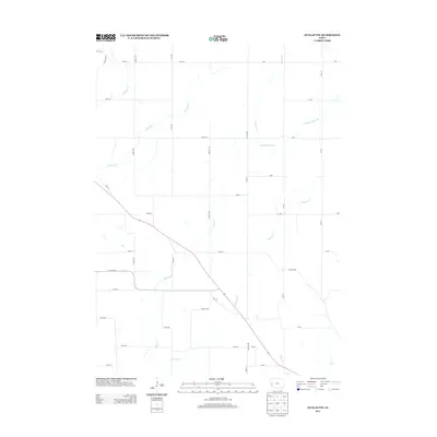
2013 Map of Dunlap NW
USGS Topo · Published 2013About this map
The agricultural landscape of Crawford County is defined here by a network of drainage basins, most notably the several branches of Willow Cr. This rural territory shows a highly organized section line road grid, with routes like Spruce Ave and Walnut Ave providing access to the fertile Iowa uplands. The drainage pattern is complex, featuring the convergence of Middle Willow Cr, S Willow Cr, and Norway Cr, which shape the local topography.
Find a feature on this map
37 named features on this map. Tap any name to fly to it.
Don’t see what you’re looking for? This feature index may not catch every label — zoom into the map to look around manually.
Map Details
Editions of this 2013 Dunlap NW Map
This is the sole edition of this map. No revisions or reprints were ever made.
Other maps of this area

1954 · Omaha
USGS Topo · 1:250,000

1954 · Fort Dodge
USGS Topo · 1:250,000

1957 · Omaha
USGS Topo · 1:250,000

1957 · Fort Dodge
USGS Topo · 1:250,000

1958 · Omaha
USGS Topo · 1:250,000

1958 · Fort Dodge
USGS Topo · 1:250,000
1971 · Mapleton SE
USGS Topo · 1:24,000

1971 · Moorhead SE
USGS Topo · 1:24,000

1971 · Ute
USGS Topo · 1:24,000

1971 · Dunlap SW
USGS Topo · 1:24,000