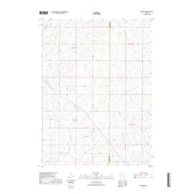
2018 Map of Dunlap NW
USGS Topo · Published 2018About this map
Willow Creek and its many tributaries, including Middle Willow Cr and S Willow Cr, dominate this agricultural landscape along the border of Monona and Crawford Counties. The terrain is defined by a dense network of sectional roads and county highways, such as Co Hwy L37 and Co Hwy E54, which follow the township and range lines established by the Public Land Survey System. These routes connect dispersed farmsteads across the loess hills, where smaller waterways like Norway Cr and Skinners Cr have carved the land. The presence of O'Banion Rd and various lettered avenues suggests the long-standing rural infrastructure of western Iowa, maintaining a pattern of settlement and land use that has persisted through the early 21st century.
Find a feature on this map
37 named features on this map. Tap any name to fly to it.
Don’t see what you’re looking for? This feature index may not catch every label — zoom into the map to look around manually.
Map Details
Editions of this 2018 Dunlap NW Map
This is the sole edition of this map. No revisions or reprints were ever made.
Other maps of this area

1954 · Omaha
USGS Topo · 1:250,000

1954 · Fort Dodge
USGS Topo · 1:250,000

1957 · Omaha
USGS Topo · 1:250,000

1957 · Fort Dodge
USGS Topo · 1:250,000

1958 · Omaha
USGS Topo · 1:250,000

1958 · Fort Dodge
USGS Topo · 1:250,000
1971 · Mapleton SE
USGS Topo · 1:24,000

1971 · Moorhead SE
USGS Topo · 1:24,000

1971 · Ute
USGS Topo · 1:24,000

1971 · Dunlap SW
USGS Topo · 1:24,000