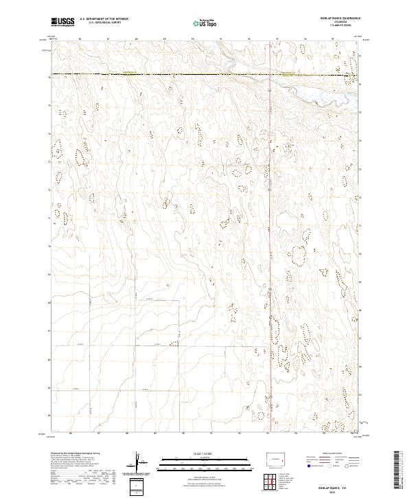
2022 Map of Dunlap Ranch
USGS Topo · Published 2022About this map
The high plains of eastern Colorado are defined by a network of seasonal water bodies and section-line roads along the Cheyenne Co Kiowa Co line. This landscape, characterized by ephemeral drainage basins, features localized landmarks such as Oswald Ranch and several named depressions including Arsenic Lake and Lewis Lake. The drainage of Rush Creek traverses the northern portion of the quadrangle, serving as a primary hydrological feature in an otherwise arid expanse.
Find a feature on this map
24 named features on this map. Tap any name to fly to it.
Don’t see what you’re looking for? This feature index may not catch every label — zoom into the map to look around manually.
Map Details
Editions of this 2022 Dunlap Ranch Map
This is the sole edition of this map. No revisions or reprints were ever made.
Other maps of this area

1891 · Kit Carson
USGS Topo · 1:125,000

1892 · Lamar
USGS Topo · 1:125,000

1893 · Kit Carson
USGS Topo · 1:125,000

1954 · Lamar
USGS Topo · 1:250,000

1958 · Lamar
USGS Topo · 1:250,000
1968 · Alkali Lake
USGS Topo · 1:24,000

1968 · Hawkins
USGS Topo · 1:24,000
1968 · Eads
USGS Topo · 1:24,000

1981 · Cheyenne Wells
USGS Topo · 1:100,000

1982 · Kit Carson 4 NW
USGS Topo · 1:24,000