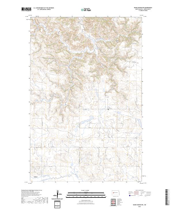
2024 Map of Dunn Center NW
USGS Topo · Published 2024About this map
Killdeer anchors the southwestern corner of this Dunn County landscape, where the town's grid meets the meandering course of Spring Creek. The terrain is defined by a series of drainages, including Gumbo Creek, Jim Creek, and Chimney Butte Creek, which cut through the high plains toward the prominence of Chimney Butte. These watercourses reveal the complex erosion patterns typical of the region's topography. Outside of the primary settlement, the land is organized by a systematic grid of section lines and rural roads such as 101st Ave NW and Main St. Evidence of early community life is preserved at the Peace Lutheran Cem, situated along 1st NW. This survey provides a contemporary view of the region's rural infrastructure and its enduring relationship with the local creek systems.
Find a feature on this map
22 named features on this map. Tap any name to fly to it.
Don’t see what you’re looking for? This feature index may not catch every label — zoom into the map to look around manually.
Map Details
Editions of this 2024 Dunn Center NW Map
This is the sole edition of this map. No revisions or reprints were ever made.
Other maps of this area

1953 · Watford City
USGS Topo · 1:250,000

1957 · Watford City
USGS Topo · 1:250,000

1967 · Watford City
USGS Topo · 1:250,000

1970 · Lost Bridge
USGS Topo · 1:24,000

1970 · Dunn Center NW
USGS Topo · 1:24,000

1970 · Mandaree SW
USGS Topo · 1:24,000

1970 · Dunn Center NE
USGS Topo · 1:24,000

1970 · Mandaree SE
USGS Topo · 1:24,000

1973 · Dunn Center
USGS Topo · 1:24,000

1973 · Lake Ilo
USGS Topo · 1:24,000