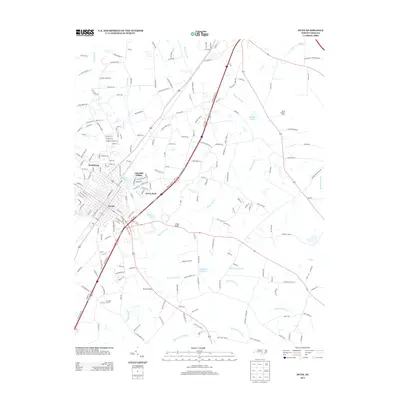
2013 Map of Dunn
USGS Topo · Published 2013About this map
Dunn serves as the central hub of this quadrangle, shown here in the early 21st century as a dense network of residential and commercial streets. The city is flanked by smaller communities like Westhaven to the west and Lakeside Village near Hannas Lake. A notable concentration of water bodies including McLambs Pond, Jernigan Pond, and Hayner Pond punctuates the landscape, indicating the importance of these low-lying areas for drainage and local recreation.
Find a feature on this map
196 named features on this map. Tap any name to fly to it.
Don’t see what you’re looking for? This feature index may not catch every label — zoom into the map to look around manually.
Map Details
Editions of this 2013 Dunn Map
This is the sole edition of this map. No revisions or reprints were ever made.
Other maps of this area

1906 · Four Oaks
USGS Topo · 1:48,000

1908 · Four Oaks
USGS Topo · 1:62,500

1909 · Coharie
USGS Topo · 1:62,500

1953 · Raleigh
USGS Topo · 1:250,000

1954 · Raleigh
USGS Topo · 1:250,000

1973 · Benson
USGS Topo · 1:24,000

1973 · Dunn
USGS Topo · 1:24,000

1973 · Erwin
USGS Topo · 1:24,000

1973 · Coats
USGS Topo · 1:24,000
1974 · Wade
USGS Topo · 1:24,000