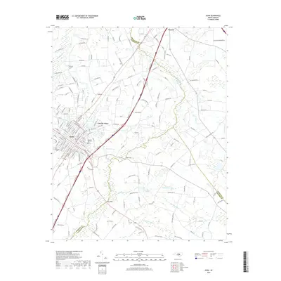
2019 Map of Dunn
USGS Topo · Published 2019About this map
The city of Dunn serves as a central hub on this 2019 survey, characterized by a dense grid of streets including S Fayetteville Ave, N General Lee Ave, and W Broad St. This area at the intersection of Harnett, Johnston, and Sampson counties reveals a landscape defined by significant drainage systems, where Mingo Swamp and Big Juniper Run weave through the eastern reaches. The map identifies key local landmarks such as Greenwood Cem and the Resthaven Memorial Park within the city, while the peripheral settlements of Lakeside Village and Benson illustrate the northward expansion of the regional corridor.
Find a feature on this map
178 named features on this map. Tap any name to fly to it.
Don’t see what you’re looking for? This feature index may not catch every label — zoom into the map to look around manually.
Map Details
Editions of this 2019 Dunn Map
This is the sole edition of this map. No revisions or reprints were ever made.
Other maps of this area

1906 · Four Oaks
USGS Topo · 1:48,000

1908 · Four Oaks
USGS Topo · 1:62,500

1909 · Coharie
USGS Topo · 1:62,500

1953 · Raleigh
USGS Topo · 1:250,000

1954 · Raleigh
USGS Topo · 1:250,000

1973 · Benson
USGS Topo · 1:24,000

1973 · Dunn
USGS Topo · 1:24,000

1973 · Erwin
USGS Topo · 1:24,000

1973 · Coats
USGS Topo · 1:24,000
1974 · Wade
USGS Topo · 1:24,000