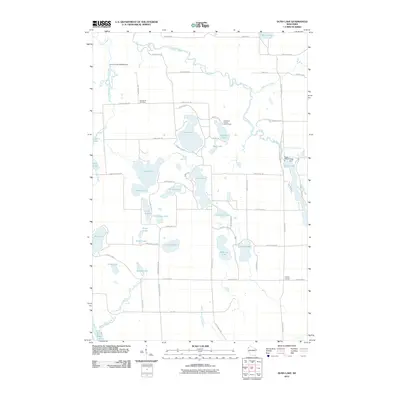
2010 Map of Dunn Lake
USGS Topo · Published 2010About this map
The Namekagon River winds through this glacial landscape of Northwest Wisconsin, defining a terrain dominated by an intricate network of kettle lakes and wetlands. The waterway is managed by several structures, including the Conroy Ford 3WR374 Dam and the WP220 Trego Dam, the latter of which forms Trego Lake in the east. This 2010 survey illustrates a region largely dedicated to recreation and conservation, notably housing the Washburn County Youth Camp on the shores of Leisure Lake.
Find a feature on this map
63 named features on this map. Tap any name to fly to it.
Don’t see what you’re looking for? This feature index may not catch every label — zoom into the map to look around manually.
Map Details
Editions of this 2010 Dunn Lake Map
This is the sole edition of this map. No revisions or reprints were ever made.
Other maps of this area

1947 · Minong
USGS Topo · 1:48,000

1948 · Spooner
USGS Topo · 1:48,000

1949 · Hertel
USGS Topo · 1:48,000

1949 · Minong
USGS Topo · 1:48,000

1949 · Webb Lake
USGS Topo · 1:48,000

1949 · Spooner
USGS Topo · 1:48,000

1953 · Ashland
USGS Topo · 1:250,000

1953 · Duluth
USGS Topo · 1:250,000

1953 · Rice Lake
USGS Topo · 1:250,000

1953 · Stillwater
USGS Topo · 1:250,000