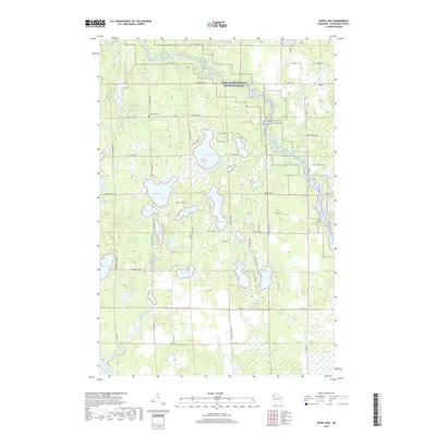
2019 Map of Dunn Lake
USGS Topo · Published 2019About this map
The Saint Croix National Scenic Riverway protects the northern reach of this landscape, where the Namekagon River and St. Croix Wild and Scenic River define the local hydrology. This 2019 survey captures a complex network of glacial kettle lakes and wetlands in Washburn County, punctuated by prominent bodies of water like Dunn Lake, Island Lake, and McKinley Lake. Cultural landmarks are centered around the quiet Rosewood Cem and a dense system of rural roads such as Co Hwy K and Island Lake Rd. The map illustrates a contemporary balance between recreational water resources like Trego Lake and the preserved riparian corridors of the national river system. Numerous small tributaries, including McKenzie Cr and Rocky Ridge Creek, connect these interior basins to the larger river system, reflecting the intricate drainage patterns of the Wisconsin northwoods.
Find a feature on this map
81 named features on this map. Tap any name to fly to it.
Don’t see what you’re looking for? This feature index may not catch every label — zoom into the map to look around manually.
Map Details
Editions of this 2019 Dunn Lake Map
This is the sole edition of this map. No revisions or reprints were ever made.
Other maps of this area

1947 · Minong
USGS Topo · 1:48,000

1948 · Spooner
USGS Topo · 1:48,000

1949 · Hertel
USGS Topo · 1:48,000

1949 · Minong
USGS Topo · 1:48,000

1949 · Webb Lake
USGS Topo · 1:48,000

1949 · Spooner
USGS Topo · 1:48,000

1953 · Ashland
USGS Topo · 1:250,000

1953 · Duluth
USGS Topo · 1:250,000

1953 · Rice Lake
USGS Topo · 1:250,000

1953 · Stillwater
USGS Topo · 1:250,000