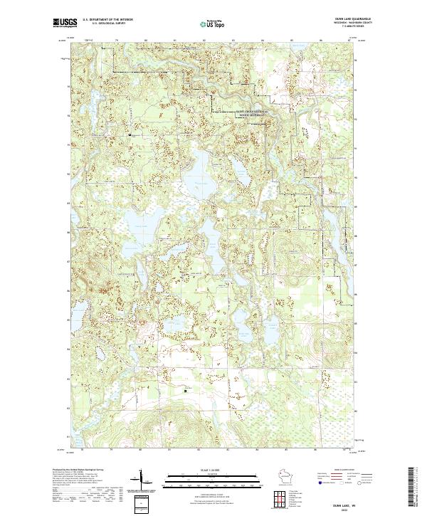
2022 Map of Dunn Lake
USGS Topo · Published 2022About this map
The Saint Croix National Scenic Riverway protects the eastern edge of this landscape, where the Saint Croix Wild and Scenic River winds through Northwest Wisconsin. This territory is defined by a dense concentration of glacial water bodies, including Dunn Lake, Casey Lake, and McKinley Lake. The land is networked by rural routes like Leisure Lake Rd and Casey Lake Rd, reflecting a region shaped by outdoor recreation and small-scale forestry. For those researching family history, the map preserves the locations of Rosewood Cem and Fox Cem. The topography shifts from the numerous low-lying wetlands and springs, such as Boyle Brook Spring, to more prominent features like Rocky Ridge in the south, illustrating the varied terrain of Washburn County.
Find a feature on this map
84 named features on this map. Tap any name to fly to it.
Don’t see what you’re looking for? This feature index may not catch every label — zoom into the map to look around manually.
Map Details
Editions of this 2022 Dunn Lake Map
This is the sole edition of this map. No revisions or reprints were ever made.
Other maps of this area

1947 · Minong
USGS Topo · 1:48,000

1948 · Spooner
USGS Topo · 1:48,000

1949 · Hertel
USGS Topo · 1:48,000

1949 · Minong
USGS Topo · 1:48,000

1949 · Webb Lake
USGS Topo · 1:48,000

1949 · Spooner
USGS Topo · 1:48,000

1953 · Ashland
USGS Topo · 1:250,000

1953 · Duluth
USGS Topo · 1:250,000

1953 · Rice Lake
USGS Topo · 1:250,000

1953 · Stillwater
USGS Topo · 1:250,000