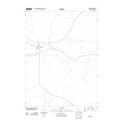
2011 Map of Dunning
USGS Topo · Published 2011About this map
Dunning serves as the focal point of this rural Blaine County landscape, situated precisely at the confluence where the Dismal River meets the Middle Loup River. The village layout is concentrated along the northern bank, featuring essential civic landmarks like the Dunning Post Office and the Dunning City Police station. The surrounding terrain is defined by the braided paths of these two sandhills waterways, which dominate the topography and dictate the local road network.
Find a feature on this map
9 named features on this map. Tap any name to fly to it.
Don’t see what you’re looking for? This feature index may not catch every label — zoom into the map to look around manually.
Map Details
Editions of this 2011 Dunning Map
This is the sole edition of this map. No revisions or reprints were ever made.
Other maps of this area

1948 · Linscott
USGS Topo · 1:62,500

1950 · Linscott
USGS Topo · 1:62,500

1951 · Dunning
USGS Topo · 1:62,500

1951 · Anselmo NW
USGS Topo · 1:24,000

1952 · Brewster SW
USGS Topo · 1:24,000

1952 · Brewster NW
USGS Topo · 1:24,000

1954 · North Platte
USGS Topo · 1:250,000

1955 · Broken Bow
USGS Topo · 1:250,000

1956 · Broken Bow
USGS Topo · 1:250,000

1956 · North Platte
USGS Topo · 1:250,000